|
Index...
|
 ill Lane gate (illustrated by an 1840 lithograph by Miss Eld, pictured left), or Bastille gate as it was first known, was built close to the confluence of the Sherbourne and the brook emanating from Swanswell Pool. The elephant shaped sports centre, erected in the mid 1970s (and no longer in use), stands over the ground once occupied by the gate.
Of all the gates that have disappeared, this one was demolished the most recently, in 1849 - most of the others went in the 18th century. On Friday 12th October 1849 the Coventry Herald reported that the Tuesday meeting of the Local Board of Health had been informed by the Town Clerk that the Mill-Lane tower had sold for £15 and removal would commence the next day, Wednesday 10th.
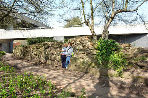
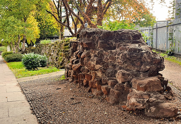
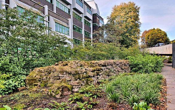
Proceeding eastwards from where Mill Lane gate used to stand, the stretch of wall we see on the left is the first part you will come to. It is now the longest existing section of wall, around two hundred metres in length, stretching to just west of the Sky Blue Way / ring road island.
It is apparent and rather unfortunate, however, that most of what survives of the wall structure here is only the rough inner part. The town wall's construction consisted of two walls made of properly cut stone, infilled with small stones and rubble, then filled with lime mortar.
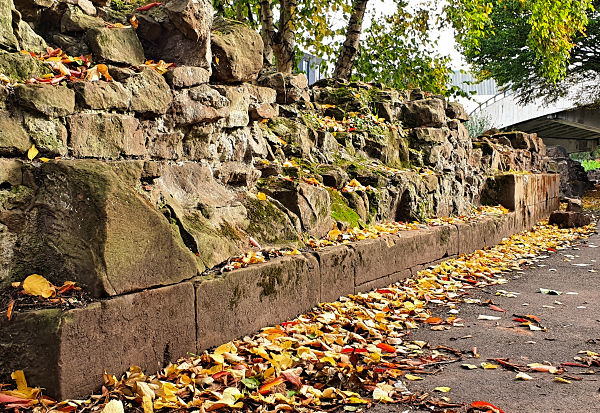
The picture on the right demonstrates that just a few 'proper' cut stones can be seen remaining. These neatly cut outer stones used for facing a wall were known as 'ashlar'. However, as is evident here, most of the usable outer stones were taken away, put to good use in the construction of other buildings.
The picture below is farther west on the "inside" of the wall looking towards Sky Blue Way.
It is along this section of wall that the final construction of the partially redesigned circuit was completed in 1534.
Below is the continuation of the wall, viewed from the south, or "inside" of the wall, looking to the north-east.
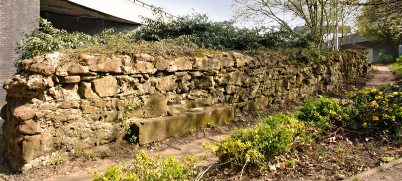
This last photograph shows the eastern end of the remains, closest to Sky Blue Way. If I had taken this shot in medieval times, I would have been standing in the river Sherbourne on the outside of the wall, looking westward towards the centre of Coventry.
Website by Rob Orland © 2002 to 2026