|
Index...
|
 he original line of the wall between Swanswell and Mill Lane gates was rather different to the finished product seen laid out in John Speed's map of 1610.
The initial path taken by the wall before it was re-routed to encompass the Prior's land is shown by the thinner yellow line in the map linked on the right. From the south east corner of Swanswell Gate, the wall continued in that direction, taking the shortest route to the river, where it turned sharply south and crossed over at the place where, in 1856-57, the newly built Priory Street was to be laid. At this point the Sherbourne flowed west to east, roughly following the route of modern day Fairfax Street (under which it is now culverted).

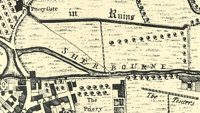
The 1749 Bradford plan of Coventry (see snippet on the left) clearly shows the early line of the wall as a dotted line which, years after the wall had been removed and St. Osburg's Pool (now Pool Meadow) had been drained, became a footpath from Priory Gate to the bridge into grounds of the former Priory.
However, in 1462 Prior Shotswell made several pages worth of complaints to the mayor (William Pere), among which he expressed his annoyance at fish being stolen from his pool and people washing in it. At the request of the Prior (and much heated debate), it was eventually agreed that the wall be diverted at great expense to enclose the pool.
For some years, historians have been divided on the matter of whether or not the wall south of the Sherbourne was ever built, with Dr. Eileen Gooder, in her super 1971 book Coventry's Town Wall finding evidence to claim that the wall enclosing the pool was the only one built at Pool Meadow, and therefore the wall south of the river had never been erected in the first place. However, evidence in the leet book recorded in 1480 overwhelmingly supports the fact that the wall was first built on the Prior's land south of the Sherbourne, around 1403, then removed so that his pool could be enclosed. The full Leet entry pertaining to this is laid out on the next page.
In the 1930s, while much alteration was happening around the centre of Coventry, John Bailey Shelton took the opportunity to excavate many sites, and he discovered the remains of a tower at the junction with Hales Street and what used to be the entrance to New Buildings. This tower would nowadays be approximately at the entrance to Sainsbury's at the bottom of Trinity Street. According to J. B. Shelton, this was known as "Priory Tower". Although almost certainly not part of the outer city wall, his find might have been an inner tower or watch tower, possibly used as an armoury.

If you wish to read about this, and much more about John Bailey Shelton's numerous excavations, you may like to read his 1930s Austin's Monthly Magazine articles, the complete collection of which I have published online here with kind permission from his family.
The Prior's pool was eventually to become the Pool Meadow with which we are now familiar after being drained from the marsh-land that it had become by the early 19th century.
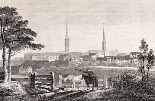
The beautiful view of 1809 on the right shows the land across Pool Meadow, looking southward towards the churches of St. Michael's and Holy Trinity.
If you'd like to see how this view compares with today's scene, please click here to see a now and then pairing.

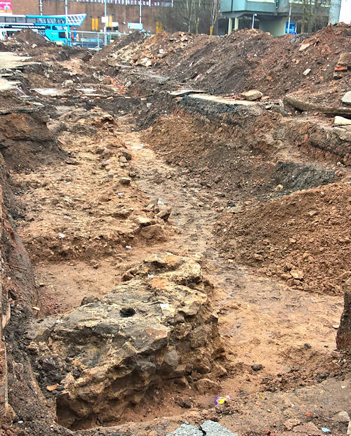
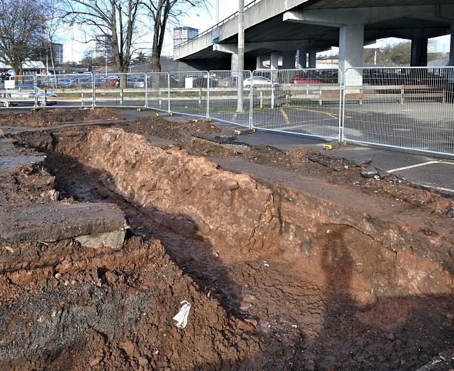
As the construction of Coventry University student accommodation was about to be begun on the site of the Pool Meadow car-park, across the road from the Fairfax Street swimming baths, archaeologists moved in to survey the area, and uncovered a long hidden section of city wall. It's not a spectacular piece, and only consists of the rubble infill - no neatly cut ashlar stones - but the revealing of this little chunk of our wall has enabled me to accurately pinpoint the position of the northern stretch that once encompassed the Prior's fishing pool. On the map, the north-south stretch of wall to the right of Pool Meadow is the part that was briefly on show.
The eastern extremity of the dig also appears to reveal part of the angled tower, or circular bastion, that formed the point where the wall turned to the south, as can be noted in the 1749 Samuel Bradford plan of Coventry. The diagonal piece jutting out at the bottom of the photo on the left would've been part of the tower that formed the wall's corner. Above that can be seen the rough infill of the wall as it stretched southwards towards where it again crossed the Sherbourne. It doesn't appear very straight in the photo, but the fact that the neat outer-stones were removed centuries ago, leaving only the rough "wall filling", would seem to account for this.

Once the wall had crossed to the south side of the river, it continued south-eastwards, using the Sherbourne as a natural moat, until reaching the gate that terminated Mill Lane, which sat where our now disused elephant shaped sports centre stands.
Website by Rob Orland © 2002 to 2026